San Antonio, Texas
|
|
San Antonio, Texas |
San Antonio, Texas. The cultural and commercial center for the Río Grande Valley, is famous for its Spanish heritage and its unique mix of Mexican, Anglo, and German cultures.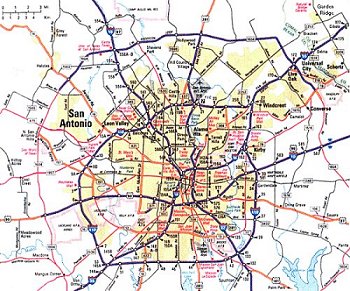
|
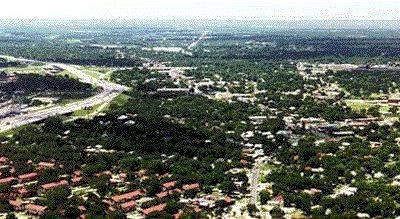
 The city is located in an area of rolling hills on the San Antonio River and San Pedro Creek, which issue from springs in the city. The streams bubble forth from the huge Edwards Aquifer, San Antonio's only source of water, which collects rainwater from the Texas Hill Country to the northwest and channels it underground through porous limestone. |
 |
 |
|
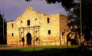
In 1691 Spanish explorers named the San Antonio River for Saint Anthony of Padua because they first encountered it on the saint's feast day. The city itself grew out of the Royal Presidio of San António de Béjar, a fortified settlement founded in 1718. It was built to protect the Mission San António de Valero established at the same time. The mission soon became nicknamed the Alamo, and because of the role it played in the Texas Revolution (1835-1836) has become San Antonio's premier landmark and a shrine to Texas independence. |
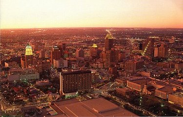
San Antonio is a picturesque city that is noted for its plazas, numerous parks, spacious residential districts, and many buildings of historic interest. The city itself covers a land area of 862.2 sq km (332.9 sq mi). It is the heart of a metropolitan area, composed of the counties of Bexar, Comal, Guadalupe, and Wilson, with a land area of 8616.4 sq km (3326.8 sq mi). Some 34 cities and towns are located in the metropolitan region, most of which are relatively small.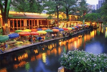
|
To go to numbers in San Antonio click on image 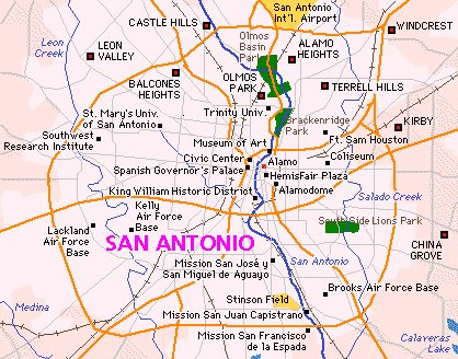 Six small cities exist as enclaves within San Antonio itself: Leon Valley, Alamo Heights, Terrell Hills, Castle Hills, Balcones Heights, and Olmos Park. |
 |
The Marion Koogler McNay Art Museum displays works by some of the finest painters of the postimpressionism style,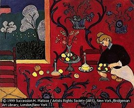 |
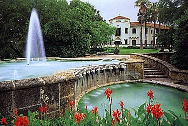
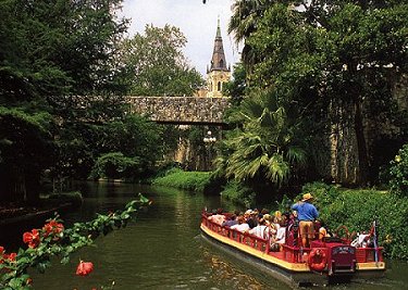
| The narrow upper course of the San Antonio River, spanned by many bridges, winds through the city, making a horseshoe-shaped bend around the central business district. Along its banks in midtown is the Paseo del Rio, or River Walk, a popular walkway with shops and restaurants shaded by large cypress and palm trees. Scenic excursions aboard small riverboats through the district is one of the city's premier activities for visitors. |
 |
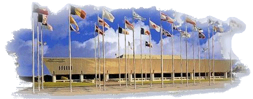
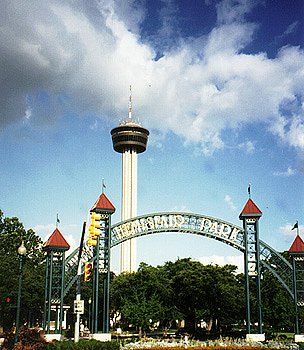 HemisFair Plaza Entrance |
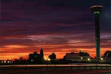
HemisFair Plaza, site of a world's fair in 1968 celebrating the city's 250th anniversary, adjoins the river. The site of downtown recreation and entertainment, the plaza contains a convention center and the Tower of the Americas, a spire 190 m (622 ft) high that affords panoramic views of the city. The river winds past La Villita, or The Little Village, a complex of restored buildings from the city's earliest residential settlement and now an arts and crafts community. To the west of downtown San Antonio is Market Square, patterned after markets in Mexico. Immediately south of downtown, along the river, is the King William District, an area settled in the 19th century by wealthy Germans and noted for its unique architecture. |
|
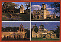
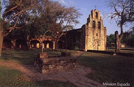
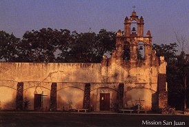
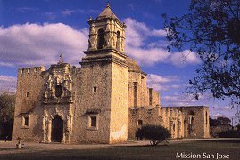
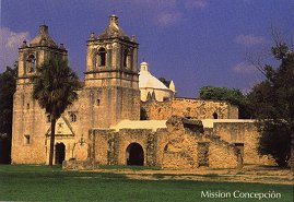
Spaced along the river south of downtown San Antonio are the four missions constructed by the Spanish that comprise the San Antonio Missions National Historical Park: |
 |
 |
Other important architectural sites in the city are the Spanish Governor's Palace (completed in 1749), once the seat of Spanish government in Texas; San Fernando Cathedral, originally constructed by workers from the Canary Islands after they arrived in 1731 and rebuilt in 1873 after a fire; the Quadrangle at Fort Sam Houston (1878); and the Bexar County Courthouse, constructed of pink granite and sandstone and completed in 1895. |
|
The population of San Antonio grew from 786,023 in 1980 to 935,933 in 1990, according to the national census. By 1996 the population had reached 1,067,816. In the years between official censuses the San Antonio metropolitan area grew from 1,071,954 to 1,302,099. By 1995 the population had reached an estimated 1,460,809. According to the census, whites are 72.3 percent of the population, blacks 7.0 percent, Asians and Pacific Islanders 1.1 percent, and Native Americans 0.4 percent. The remainder are of mixed heritage or did not report ethnicity. San Antonio is distinctive for its large number of residents with Hispanic heritage, composing 56 percent of the population in the city and 48 percent of the metropolitan region. Hispanic is considered by the census to be a linguistic and cultural distinction rather than a racial category and Hispanics can therefore be of any race; in San Antonio most are white. |
|
|
The Anglo and more affluent minority populations have over the years moved to outlying areas north and east of the downtown, where rolling hills make attractive home sites and retirement developments. San Antonio's population growth can be partially explained by its desirability as a retirement community, with excellent medical facilities and attractive geographic surroundings. But more important, San Antonio serves as a cultural and economic magnet for immigrants from Mexico and the Río Grande Valley, which is predominantly Hispanic in ethnic origin and cultural sensitivities. |
|
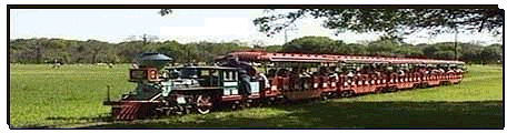
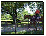
Rides on a historic carousel, an aerial tram, a model train, and horses are all available at
Brackenridge Park, San Antonio's leading recreational facility. Inside the park is the Japanese Tea Gardens, with winding walkways, stone bridges, and calm pools in what was once a rock quarry.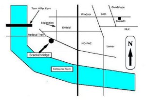 |
|
|
also in the park, is one of the nation's largest zoos, with more than 700 species on display.  San Antonio Zoological Gardens and Aquarium |
 The San Antonio Biological Gardens and Conservatory is a 13-hectare (33-acre) horticultural facility that specializes in Texas flora. |
|
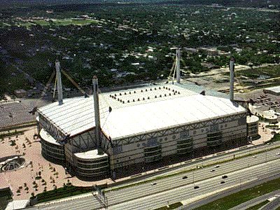
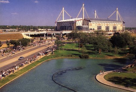
The dome also serves as the site for the Alamo Bowl, an annual post-season college football game. |
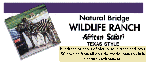
Natural Bridge Wildlife Ranch |
and |
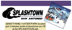
Splashtown |
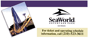 Sea World of Texas |
and | 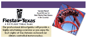 Fiesta Texas |
 |
and |  |

|
|

 For Information & Reservations |
 For Tickets & Tour Information |
 Tickets sold at Alamo Visitor Center & Texas Adventures |
 For Tickets & Tour Information |
|
San Antonio by the mid-1990s had become the ninth largest city in the United States. Its economy historically was based on providing commercial, manufacturing, and financial services for an agricultural area extending to the south and west of the city. With plentiful attractions and pleasant weather when much of the nation is experiencing cold winter weather, San Antonio has also become a frequent convention host and tourist destination. Manufactures include refined petroleum, processed food, apparel, microprocessors and semiconductors, agricultural equipment, aerospace equipment, and eyewear. |
San Antonio has also relied economically on a strong military presence. Located near the city are Fort Sam Houston, the headquarters of the Fifth Army and home to the huge Brooke Army Medical Center; Randolph Air Force Base, headquarters of the Air Education and Training Command; Brooks Air Force Base, home to the School of Aerospace Medicine; and Lackland Air Force Base, a major training center for recruits. While national reductions in the size of the military during the 1990s damaged the city's economy, during the same period the tourist industry increased in importance. The health service sector also grew, as San Antonio emerged as the center for health care for the Río Grande Valley and northern Mexico. Biosciences-related research, as well as applied engineering and physical sciences research and development, is being carried out in San Antonio at the Southwest Research Institute and the Texas Research Park. A major spur to the economy has been the North American Free Trade Agreement (NAFTA), which allows the area to draw upon its historic links to Mexico and to solidify its credibility as an international financial center. It was chosen, for example, as the site of the North American Development Bank |

|
 |
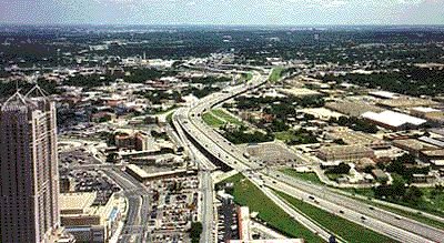
Two of the nation's principal interstate freeways cross in San Antonio. Interstate 10, the main route across the southern United States, connects the city with Houston to the east. Products from Mexico are frequently transported on Interstate 35, which also ties the city to the Dallas-Fort Worth metropolitan region to the north. Interstate 37 links the city with Corpus Christi on the Gulf of Mexico. San Antonio has good railroad connections to the nation as well as passenger train service. Air transportation is through San Antonio International Aiport. San Antonio's government consists of a council composed of 11 members elected for two-year terms. Ten members are selected from districts; the 11th is chosen by voters citywide and acts as mayor. The council appoints a city manager, who administers the city under policies established by the council. |
|
By 1731 three other missions were operating in the river valley south of Mission San José. In that same year a group from the Canary Islands arrived, persuaded by the Spanish to move to the frontier, and established a community named Villa de San Fernando. Later this community was consolidated with the presidio and with the small settlement that had developed around the earliest mission to form the community of San Antonio. During much of the 18th century, the San Antonio area was dominated by Mission San José, which flourished as one of the most prosperous and influential missions in Texas. Then, in 1793, nearly all the missions in Texas were secularized and most of the mission buildings in the San Antonio area were abandoned. |
|
 |
After Texas entered the Union in 1845, the city enjoyed rapid growth as the servicing and distribution center for the western movement of settlers. In 1860 its population was the largest in Texas, with German immigrants outnumbering both the Anglo and Hispanic populations. The city served as a Confederate depot during the American Civil War (1861-1865). But lacking a port or complex transportation network, the city's economic importance was limited until the coming of the Galveston, Harrisburg, and San Antonio Railroad in 1877. Thereafter it emerged quickly as the shipping and manufacturing center of southern and western Texas. Until 1910 most of the new immigrants to the area were Anglos from southern states, and the city grew to about 70,000 inhabitants. |
| The advent of the automobile allowed San Antonio citizens to migrate toward the north and away from the downtown. The migrations heightened tensions in the 1920s and 1930s between a growing Hispanic population, located mostly on the west side of the city, and the more affluent Anglo suburbs. The lack of high paying manufacturing jobs and the reliance on government and tourist industries kept San Antonio in the bottom tier income compared to other cities in the state, and the difference in Anglo and Hispanic incomes heightened the ethic tensions. One result was a reluctance on the part of Anglo leadership to undertake urban renewal and flood control projects for the downtown areas. |
|
 |
Renewal projects were expanded in the 1960s, as Hispanics began the domination of San Antonio politics and as tourism became the most important segment of the area's economic well-being. Two important events in this ongoing process were the receiving of federal funds for HemisFair, a world's fair that highlighted San Antonio and its downtown area and culture, and the election in 1981 of Henry Cisneros, the first Hispanic mayor of a major American city. These events demonstrated the importance of cleaning up and rebuilding the downtown and signified the political accommodation of Anglo and Hispanic politicians. |
|
San Antonio still faces complicated economic problems. In 1995 a federal commission voted to close Kelly Air Force Base, site of the economically important Air Logistics Center, as part of a nationwide consolidation program. A more far-reaching problem is the fragility of the city's water supply. The Edwards Aquifer, the principal source of water for the metropolitan area, is being depleted through overuse and periodic spells in which rainfall is insufficient to recharge it. Meeting the various residential, industrial, and agricultural demands on the water source may do much to shape the future of San Antonio in terms of both population growth and manufacturing expansion in surrounding areas. |
 |